Sept. 2 thru 10, 2024

Sept. 2 thru 10, 2024 |
 |
Our trip began with a flight to Bozeman, Montana. We got off the flight, picked up our checked bags, proceeded to the Budget counter, and quickly got our car: a Toyota RAV 4. It was a reliable steed and got over 35 mpg! Over the next 8 days, we traveled a 500 mile loop around both parks and we stayed at a different lodging every night, except for two nights at Colter Bay Lodge in Grand Tetons National Park.
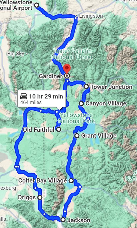
From the airport we took off south towards our first night at the Antler Lodge in Gardiner Montana.
|
|
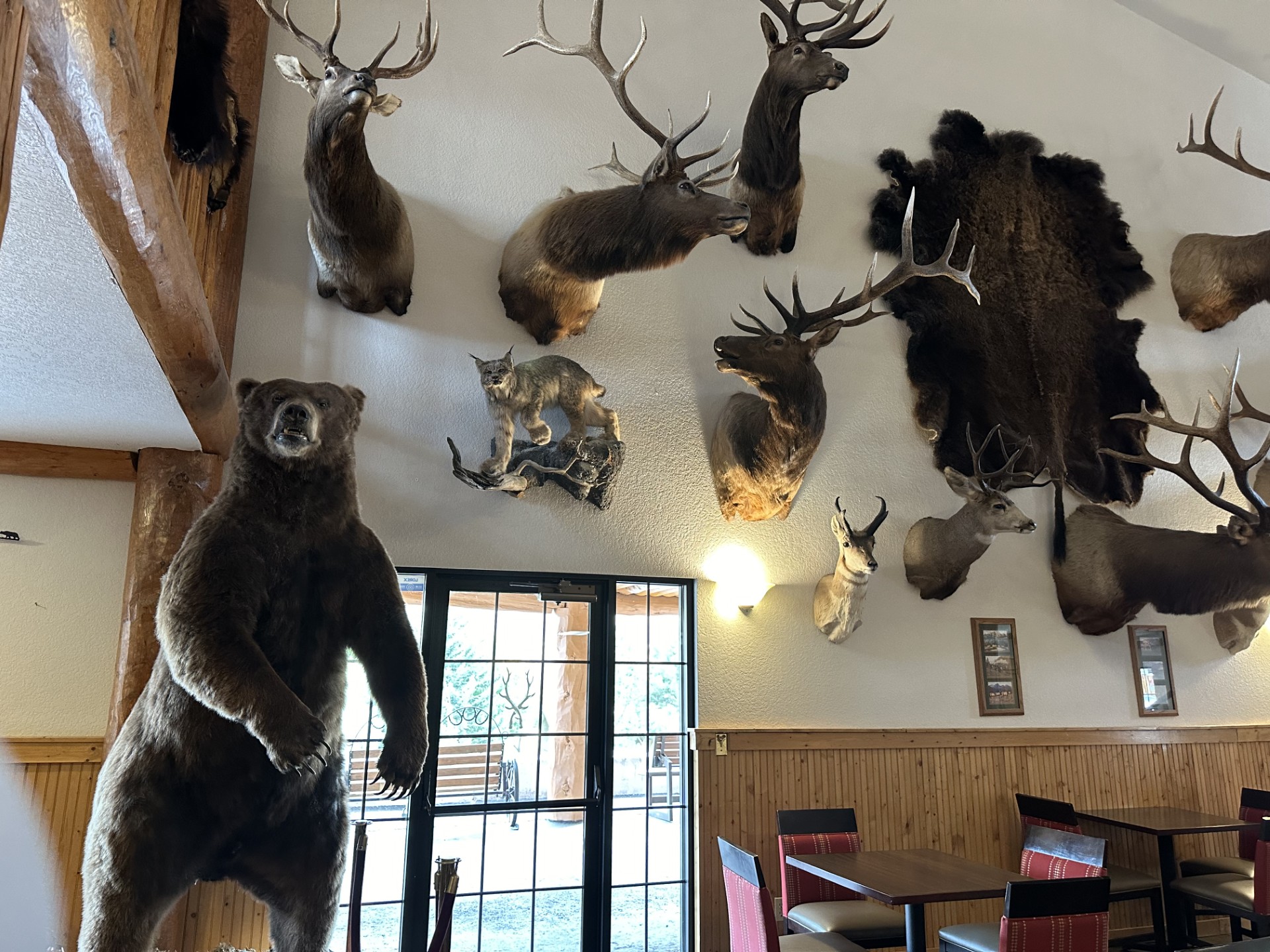
The dining room / lobby of the
Antler Motel. This is one half of one of the
walls with stuffed animals. |
That night we had dinner at the Wonderland Cafe where we shared a cup of
the BEST Bison chili I ever had. I had a Bison burger (tastes a LOT like
beef...hmm?) and June had a big, soggy Caesar salad.
A short block away from the cafe was this sign. We waited in line to have someone take our picture...
| |
|
The actual North Entrance is
about a mile from here. Yellowstone is America's first
National Park! |
| |
|
...a herd of Elk |
Our next stop, very soon after entering the park, would be the Mammoth Hot Springs resort area. We were now in Wyoming! Later, while writing this, I discovered that the 45th parallel runs right through here. That is the point half way from the equator (near Equador in South America) and the north pole, where Santa Claus lives.
We walked for about an hour among the geothermal hot springs features, punctuated with wooden decking and stairs for most of the walk.
| |
|
Mammoth Hot Springs |
| |
| We took a ridiculous amount of
pictures here. |
But we'll show just one more...
| |
| This Black-Billed Magpie REALLY wanted her
picture taken. They are very common in Wyoming, but I have never seen one. But they are related to Jays and Crows. |
Following Mammoth, we stopped at Undine Falls where we just happened to pull out. There was no hike involved, but just a picture from the pullout.
BTW: The Yellowstone River runs Northeast about 700 miles from Yellowstone Lake, near Grant Village, to join the Missouri River in North Dakota. It is the longest free-flowing river (no damns) in the continental US.
| |
|
Undine Falls |
Just up river (south), we pulled over to see this very steep canyon:
| |
|
No idea if this place has a name, but it was a bit creepy for me. |
A bit more time up river, we stopped here to see above Tower Fall. But we didn't know it at the time.
| |
|
Tower Falls from above, so named because of the 'Towers' of rock... |
| |
|
Tower Falls from the
traditional (crowded) viewing point |
The next stop was unplanned but spectacular.
| |
|
After a significant drive up in
elevation, we crossed the summit of Mt. Washburn North. |
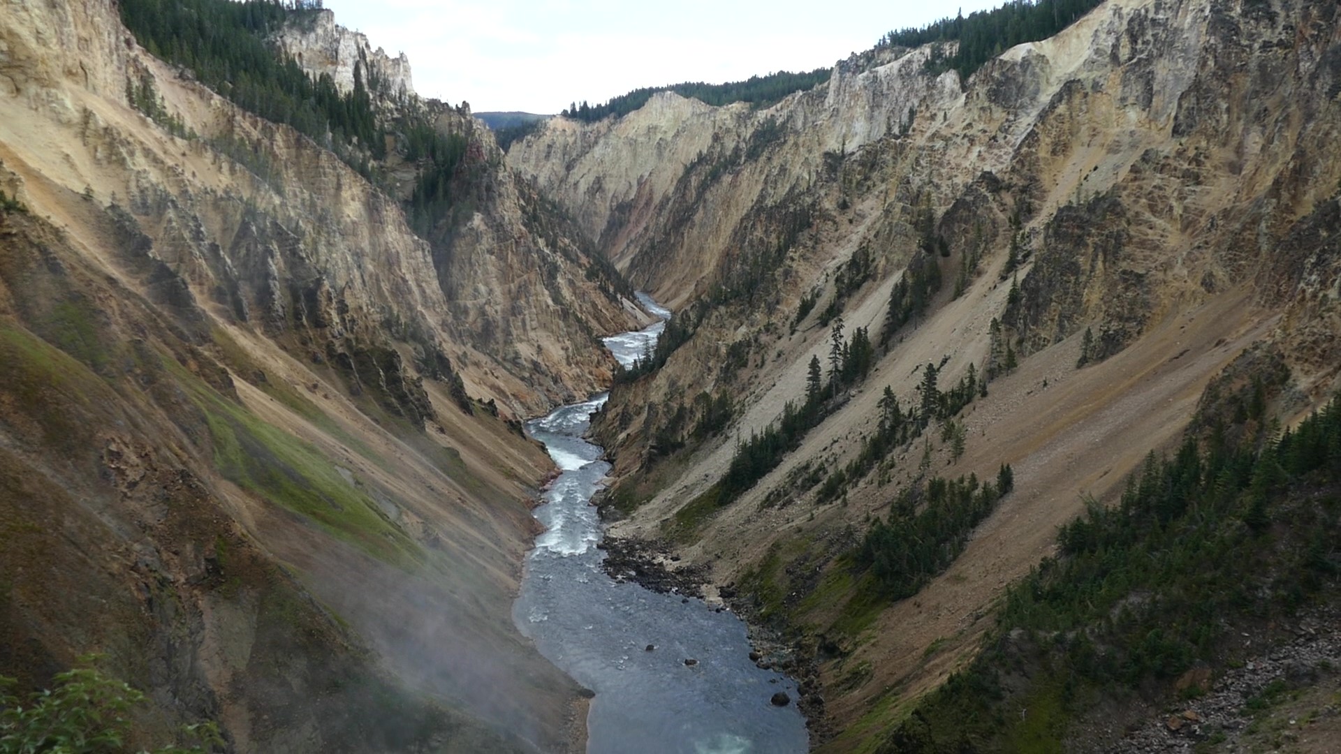
The next stop would be the Canyon Falls area where we did 3 short hikes. First, on the north side of the 'Grand Canyon of Yellowstone', we hiked down .4 miles to the Brink of Lower Falls, then 265 ft of elevation back up. We felt a few drops of rain on the way up.
 |
|
Here's the view looking down
river from the top of the falls. |
| |
|
We were standing where the
people in the picture were next to Lower Falls. |
Next we drove down river to a lookout of Lower Falls. This is an iconic picture of the Canyon area of Yellowstone. I grabbed my umbrella just in case, and again we hiked down about .4 miles. On the way down, the rain started to come along with lightning and thunder.
| |
|
Getting close to the viewing
point of Lower Falls when the lightning and heavy rain started.
|
By the time we got to the lookout point, we were there with only 2 older fellows. We each took our pictures and headed back up the 270 ft. of elevation in the pouring rain. I think they both made it out but not positive. We didn't wait for them.
| |
|
Lower Falls when it started to
pour. |
After this, we got in our RAV4 and drove to the south side of the river and up stream to a lookout of the Upper Falls. The rain cleared up, so we walked a quarter mile up to just even with the falls.
| |
|
Upper Falls from the south side
of the Yellowstone River |
Between the canyon area and Grant Village there's a place called Hayden Valley where we learned is a good place to spot wildlife. And we did.
| |
|
A Bison wandering around... |
| |
|
An Elk couple having lunch |
| |
|
A Bald Eagle sunning on the
shore of the Snake river. We saw a few cars pulled over.
One guy had a telescope which had an iPhone attached snugly to
the eyepiece. He invited people to see a closeup of the Eagle
sitting gracefully on the banks of the river. I took this pic,
not a closeup, with my 400mm zoom lens. |
At some point in the day, a couple came wandering by as traffic slowed. June was quick to grab her camera to video the second but not to quick to roll down the window...
Just after that close encounter, we pulled into a turnout called Mud Volcanos. It was like we were on Mars.
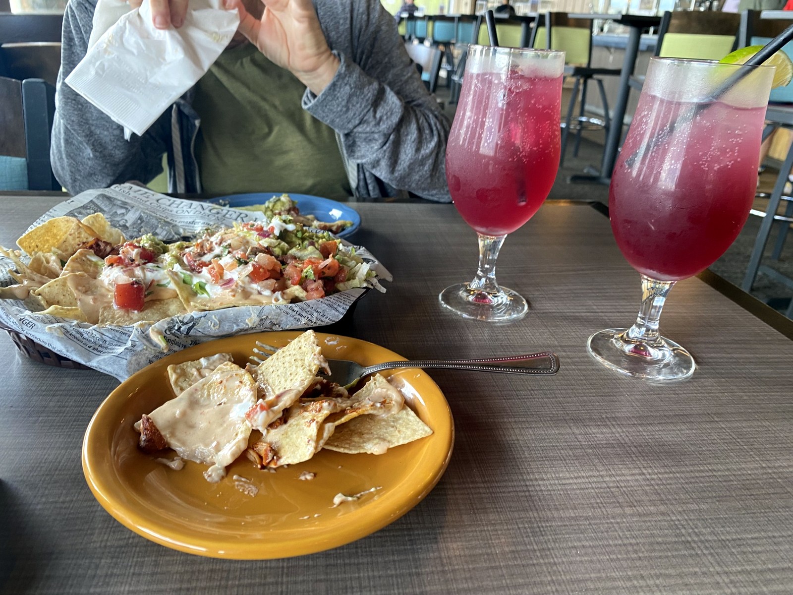
Late that afternoon we pulled into our lodging at Grant Village. We checked in and found there were two dinner choices: The large dining hall, and the Lake cafe. But only the Lake cafe was open so we strolled down to the Lake and shared a large plate of Nachos along with two Huckleberry margaritas. Both were very good. There was NO WiFi in our room, nor was there cell reception. June taught me a card game named 'Kings in the corner'. Something like solitaire but competitive.
 |
|
Our dinner at Lake Cafe in
Grant Village |
We woke up and had breakfast in the Grant Village dining hall along with about 100 hungry tourists. Our destination for the day would be straight south to Colter Bay Village in Grand Teton National Park.
The drive south was only about an hour but very beautiful with great views. As we got closer, we saw small distant previews of the Tetons. Eventually we pulled into Colter Bay and drove straight to the beach where we took in the magnificent view.
| |
|
The Grand Tetons from the beach
at Colter Bay The Grand Teton cluster on the far left (more about that later) Mt Moran is the big one on the
right |
|
Close up of Mt Moran (12,610') Jackson Lake (6,320') - similar
to Lake Tahoe |
|
Our $337/night room at Colter
Bay Village We stayed 2 nights here |
After settling in at the lodge, we took a drive to check out Signal
Mountain, which supposedly had a great view. Turns out it's a 30-minute
drive, crowed with tourists, and because of the many trees, a very small
view of the Tetons.
| |
|
The Tetons from Signal Mountain
summit |
| |
|
An unobstructed view from
just off the highway, pretty much the same vantage point as the
image above. |
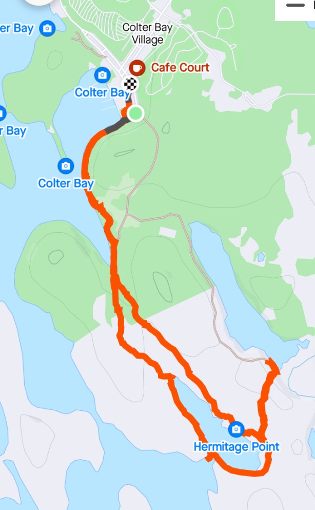
Two hours later, we headed back to Colter Bay and decided to take a 4.25 mile hike south.
. 
|
We saw only a few other people
on the walk |
| |
|
As the sun moves west later in
the day, the mountains becomes silhouetted |
We ate dinner that night at the John Colter restaurant just a short walk from our room. After a decent night's sleep, we awoke to a VERY cold room. We foraged for breakfast at the Colter Bay General Store where we got good coffee and I got a delicious breakfast sandwich. June found yogurt, fruit, a 2-pack of boiled eggs, and other supplemental snacks. Then we headed south towards Jenny Lake.
The following pic was taken from a pullout just north of Jenny Lake.
|
This cluster of peaks are all individually named, of course. The tallest 3, from left to right: Teewinot (12,330'), Grand Teton (13775'), Mt Owen (12,993) Jenny Lake is at 6,320' |
I had been looking forward to a boat ride across the lake to a trailhead that would take us up into a canyon just to the right of that cluster of mountains. But the smoke from nearby fires had moved in and the air IQ was 175 (unhealthy). So we decided to walk around the lake on relatively level ground.
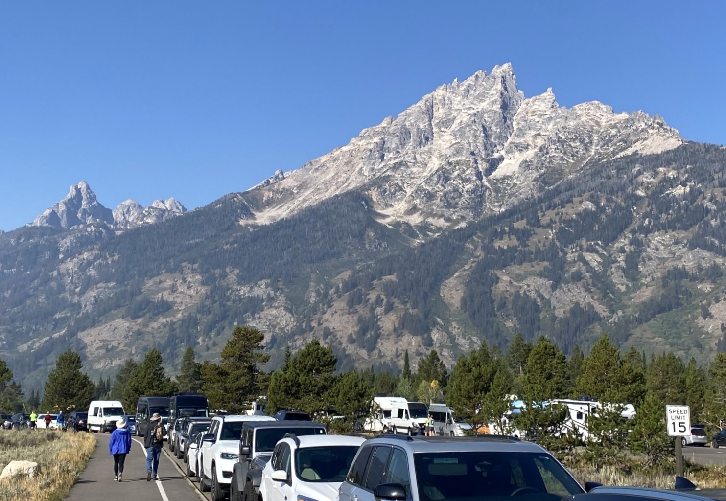
The parking situation for the boat ramp at Jenny Lake was well documented online. But I was still surprised with how crowded it was. We parked along the roadway at least a quarter mile from the boat launch area, and people were still pouring in before 10am.
 |
|
The 'parking lot' for Jenny Lake.
The peak in the foreground is
Teewinot, which blocks the view of the other peaks behind it. |
  |
|
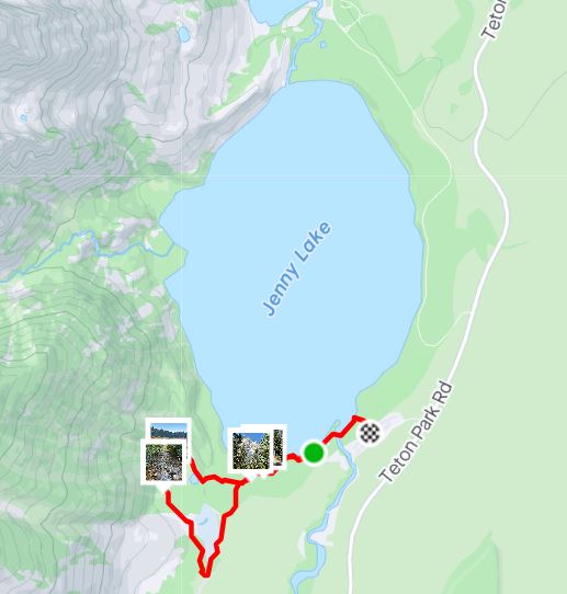
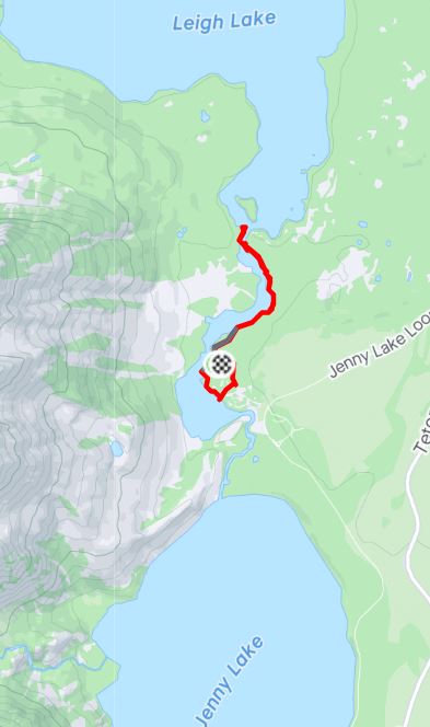
Here are the hikes that we took to Moose Lake, then String Lake and Leigh Lake. |
| |
| Bart, on the right, joined us for
most of our walk around Moose Pond. This guy was a medic/nurse for
the Army for 10 years, then the Air Force for 17 years. Now employed
as a trauma nurse in New Mexico, he was meeting a friend the
following day to climb Grand Teton! He walks with a very pronounced
limp from a repelling accident 5 years ago when he fell 85' and
broke several bones in his back. It barely slows him down. |
| |
|
View of Mt Moran from Leigh Lake. Taken by June with her iPhone |
After a combined 7+ miles of hiking, we were both hungry and decided to eat at Jackson Lake Lodge, home of two restaurants: The Mural Room (fine dining) and the Pioneer Grill.
| |
|
The Pioneer Grill is a '50's
style cafe with old pictures and nothing but counters. Julian
(far right) is from Belgium and chatted with us for way longer
than we thought advisable. |
Back at Colter Bay we enjoyed another sunset by the beach, I took a very quick swim, and then we packed for the next day's journey to Jackson Wyoming.
| |
| Sunset west over the Tetons and
Colter Bay |
Our drive to Jackson was a lot more scenic that we expected.
| |
| A herd of Bison (Not Buffalo, which is from South Asia (water buffalo) and Africa (Cape buffalo). Thanks to June for that distinction. |
| |
| Herd of Horses (these were the
only two posing in front of the mountain) |
| |
| The Snake River posing with the
mountains |
We eventually arrived in Jackson and checked into the Alpine Hotel which was quite...adequate.
Here's another fun fact: Jackson Hole and Jackson were often used interchangeably. And that's because Jackson Hole refers to the area, which contains the town of Jackson.
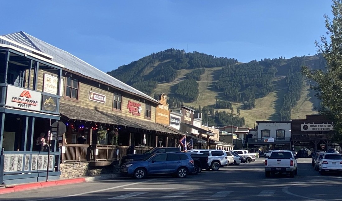 |
| Jackson is kinda like Healdsburg
with cowboy boots. This street is very small part of Jackson, Wyoming |
| |
| June with Albert Einstein - Me
with Amelia Earhart |
| |
| I'm taking a picture of a sign
that says that this arch, and the other three arches on the town
square, were made in 1960 from antlers that are shed by Elk bulls
every spring. |
That night we each had a nice salad for dinner in our hotel room while watching the Women's final of the US Open tennis tournament. In the morning we again packed up and headed east on Highway 22. But first, we stopped at the local legendary "Rendevous Park". We spent about an hour exploring the park, including...
| |
| ...This sculpture of Mama Mimi. Learn
more |
We continued east over the Targhee Pass into Idaho, then north to Driggs Idaho. We chose to go north on this route because we heard you can see the peaks of the Tetons from the west side of the mountains. We checked in early at the West Teton Hotel in Driggs Idaho, a relatively inexpensive hotel compared to others we stayed at, simply because this route was far less traveled. It was very nice, complete with a large hot tub, a free breakfast, and a small stuffed bison standing guard in the lobby.
| |
| Poor guy! |
Although we could see glimpses of the Grand Teton peaks from the highway, we decided to hike into the hills to get some exercise and hopefully a better view. Here is the map of our 4-mile 'Mill Creek' hike from AllTrails.com...
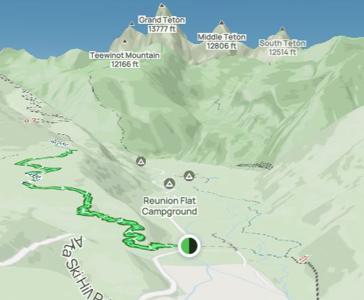
The hike up the hill was beautiful, through aspen trees and pines...and the view did not disappoint!
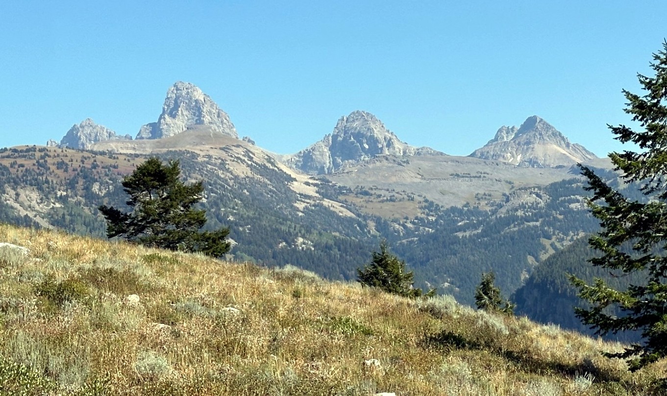 |
| The peaks from the west side of
the Tetons |
In the morning we had our free breakfast, said goodbye to the poor Bison, and hit the road north. By the end of the day we hoped to be back at the Antler Hotel in Gardiner Montana, just outside the North Entrance.
| |
| Driving north the following
morning, we got a great look at the peaks. |
We would eventually turn right at the West Yellowstone entrance. We now set our sights on Old Faithful. Here's what I learned about Old Faithful online: She is one of nearly 500 geysers in Yellowstone and one of six for which park rangers currently predict eruption times. It is not the most reliable geyser, nor is it the largest, but it IS the most reliable, large geyser. Eruptions occur every 92 minutes on average, but can range from 35 to 120 minutes. Each eruption time is predicted within plus or minus 10 minutes. Luckily we got there about 20 minutes before it erupted although there were a few false starts just beforehand.
| |
| This was during the false starts.
When it finally blew, it was 5 minutes past the prediction
and went for almost two minutes. The following video is trimmed to 50 seconds. |
Shortly after we again headed north, we came to another popular feature...
| |
| Prismatic Springs; a big,
colorful hot springs. It included a 2-mile hike. |
| |
| We saw several of these beautiful
vehicles throughout our adventures in Yellowstone. I took this picture just after the 10 or so passengers loaded up. I had to find out if this was original? Yes and No. Learn more. |
| |
| The Roosevelt Arch near the North
Entrance |
We eventually concluded our tour of Yellowstone, again at Gardiner Montana, just outside the North Entrance. We stood in line to get into the Wonderland Cafe at 5:00 pm where we shared a full bowl of the delicious Bison Chili and a non-soggy salad.
The following morning we awoke and walked to the Tumbleweed Bookstore and Cafe for a delicious breakfast and then headed north towards Bozeman. We choose a slight detour on the road less traveled for the final 20 miles before we hit the main freeway to Bozeman. June was now driving, so I asked her to pull off onto a very narrow road so that I could take yet another picture of the mountains. As I jumped out of the car, a woman was walking towards us about 50 feet away with a very tentative look on her face that seemed to say, 'Should I be afraid of you?' I tried to relieve her fears by saying that I just wanted to take a picture of these beautiful mountains. She replied, "You should see them when it's not smokey!" We chatted for roughly 20 minutes about life out in the boonies. To her, this was a very close community, physically and emotionally. She said that at one point a couple of years ago, they were snowed in for 45 days. The neighbors all pulled together to make sure they all had enough provisions.
| |
| Yeah, I guess it was pretty
smokey. |
| |
| She was so friendly and
informative, we had to get a picture with Marie |
Since we had time to kill in Bozeman, Marie suggested that we visit the
downtown area of Livingstone, Montana just east of Bozeman. So we wandered
around this quaint town and learned something interesting...
| |
|
This building is the Northern
Pacific rail station built in 1902. It was the main rail gateway
to Yellowstone Park decades before the interstate highway
system. Thousands of travelers would step off from here to
hotels in town to freshen up before catching the spur line to
Gardiner. This building was inspired by a Nation-wide campaign
to "...See America First" (before traveling to Europe).
Learn more |
Learn more about Yellowstone's Geologic History.